NASA Study Reveals California is Sinking: Detailed Map Released
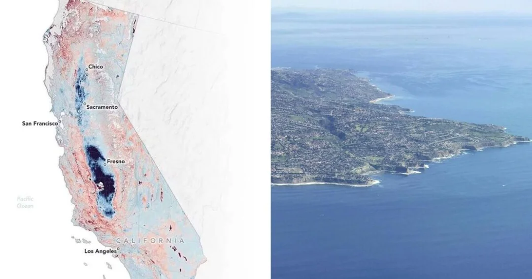
A recent study conducted by NASA has unveiled a concerning trend: parts of California are sinking at an alarming rate. The space agency released a detailed map illustrating the subsidence occurring across the state, particularly in the Central Valley region. This phenomenon, known as subsidence, is primarily driven by the excessive extraction of groundwater, which has been exacerbated by prolonged droughts and increased agricultural demands.
The map, generated using data from NASA's satellite and airborne instruments, highlights areas where the ground has subsided by as much as two feet in some locations over the past decade. This sinking land poses significant challenges, including damage to infrastructure such as roads, bridges, and canals, and increased flood risk as the land elevation decreases.
California has been grappling with water management issues for years, and this new data from NASA underscores the urgency of addressing these challenges. The state has implemented various groundwater management plans, but the findings suggest that more robust measures may be necessary to mitigate the effects of subsidence.
The implications of this study extend beyond California, serving as a cautionary tale for other regions facing similar issues. As climate change continues to impact global water resources, the need for sustainable water management practices becomes increasingly critical.