Is South Florida Drowning in a Rainy Onslaught? The Hidden Dangers Behind the Deluge
As torrential rains swept through South Florida and beyond, residents are left wondering: What happens when a much-needed downpour turns into a potential catastrophe? This intense weather event, unfolding over recent days, has brought both relief and peril to the region, underscoring the unpredictable forces of nature.
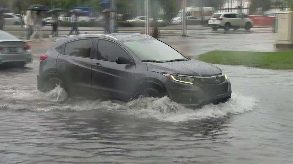
The story began with a two-day deluge that soaked South Florida, where areas like Homestead and the Everglades recorded staggering rainfall totals of up to 8.54 inches. According to the National Weather Service, much of the region was already in "extreme drought," making this rain a double-edged sword. While it promises to alleviate water shortages, the sudden influx has led to widespread flooding. In Palm Beach County, totals reached 5.2 inches in Lake Worth and Boca Raton, while Broward County saw Miramar and Plantation inundated with over 4 inches each. Meteorologist Donal Harrigan noted, "We're going to dry out beyond that," forecasting dry weather into early next week, but not before assessing damage from a potential tornado in the Loxahatchee-Wellington area.

Expanding the scope, the storm system stretched from the Gulf Coast to Virginia, affecting about 36 million people with severe thunderstorms, localized damaging winds, hail, and even tornado risks. AccuWeather warned that states like Florida, Georgia, and Alabama could see up to 10 inches of rain—equivalent to two months' worth in just days. In Miami, the situation escalated dramatically on May 12, shattering a 1943 record with 4.35 inches of rain in a single day. This deluge flooded streets as far as Interstate 75 in St. Petersburg, prompting a Level 3 flash flood risk. Eyewitness reports included a waterspout near Leesburg, adding to the chaos from weekend storms that already damaged Florida's Panhandle.
Comparatively, North Carolina and the Carolinas faced similar threats, with areas still recovering from Hurricane Helene's remnants seeing flash floods and road closures. Airports in Miami, Tampa, and Atlanta reported significant delays, with over 160 flights affected and more than 20,000 power outages across Florida, Georgia, and Alabama. This event highlights a growing trend: while the rain helps ease drought conditions—potentially erasing deficits of 2 to 9 inches below average in Florida—it exacerbates vulnerabilities in already saturated areas. Experts from the FOX Forecast Center emphasize that such extreme weather could signal broader climate patterns, where short-term benefits mask long-term risks like infrastructure strain and emergency responses.
In summary, this rainy onslaught has provided a critical reprieve for Florida's parched landscapes but at a high cost, with flooding and severe weather disrupting daily life. As the storms move northward, threatening the Mid-Atlantic, one can't help but ponder: Are these events a harbinger of more frequent extremes? What are your thoughts on how climate change is reshaping our weather? Share your experiences and opinions in the comments below, and don't forget to spread the word by sharing this article.