Wildfire Risk Maps In California Spark Urgent Debate After Devastating LA Fires
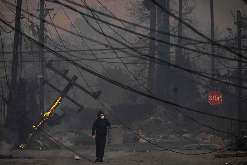
In the wake of January’s deadly wildfires that ravaged Los Angeles County and beyond, a heated debate over the effectiveness and timeliness of California’s utility wildfire risk maps has reignited. With over 16,000 buildings destroyed and communities still in recovery, the question of whether current risk tools are sufficient is more pressing than ever.
This conversation is not merely academic: nearly one in eight Californians now lives in areas officially considered high-risk for wildfires—a chilling figure highlighted by new analyses that reveal just how outdated and inadequate current risk maps are.

California’s three largest investor-owned utilities—Pacific Gas & Electric, Southern California Edison, and San Diego Gas & Electric—rely on risk assessment maps originally filed eight years ago, in 2017, to identify communities and infrastructure at greatest wildfire peril. Although the companies have made piecemeal updates, the maps remain largely unrefreshed, leaving millions of residents exposed to hazards that may not be accurately tracked.
The urgency for updates is felt intensely by consumer advocates and local officials. Cal Advocates, representing public utility ratepayers, pushed for a major overhaul: “Even its most recent mapping was in dire need of updating,” the agency wrote, arguing that updating every decade is not enough amid accelerating climate-driven risks. They proposed updates every five years, a suggestion that gained support from the utilities themselves.
However, in a controversial vote this January, the California Public Utilities Commission (CPUC) rejected this proposal. Four out of five commissioners stood in opposition, citing ongoing regulatory compliance. Adam Cranfill, a CPUC spokesperson, stated, "The CPUC is focused on monitoring utilities’ compliance with numerous rules and programs directing their activities in high fire threat areas of California." Nevertheless, for families in high-risk zones, assurances without action ring hollow.
Meanwhile, as investigators probe the origins of the fires—including the Hurst and Eaton blazes, possibly linked to utility equipment—utilities are facing intensifying scrutiny. Southern California Edison confirmed in filings that their infrastructure may have played a role, but company spokespeople have declined to specify whether updated maps could have prevented such devastation. Gabriela Ornelas, SCE spokesperson, emphasized ongoing internal reviews but deferred action to regulatory processes.
Adding complexity to the issue, some local groups have warned against granting utilities too much control over defining risk. The Mussey Grade Road Alliance, for example, highlighted the danger of allowing companies to set their own boundaries for what counts as a wildfire threat.
Pressure for change also comes from the insurance front. As fires grow in frequency and intensity, many insurers are hiking premiums or withdrawing coverage altogether. “They’re in a wait-and-see mode,” said Anish Saraiya, who leads fire recovery efforts in Altadena. The lack of accurate, up-to-date maps only deepens uncertainty for homeowners and businesses trying to rebuild or simply to protect themselves in the face of new, ever-growing threats.
Ultimately, California’s experience points to larger questions: How can technology, regulation, and community input be balanced to offer real protection in a rapidly changing environment? And as the next wildfire looms, will stakeholders act with the urgency required—or will danger continue to outpace our efforts to map it?
What do you think about the current strategy for wildfire risk mapping in California? Should updates become more frequent, or is the current regulatory pace sufficient? Share your thoughts in the comments below and join the conversation for a safer future.